A group of University of Wyoming researchers are the first to use NASA technology to get a bigger picture of wildlife in the Greater Yellowstone Ecosystem.
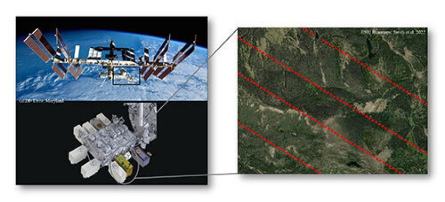
The NASA mission is called Global Ecosystem Dynamics Investigation or GEDI, and it is based on the International Space Station. It uses a light detection and ranging laser called LiDAR to collect three-dimensional observations of the Earth’s forests. This data, paired with previously available images and data, allowed scientists to further understand how wildlife interacts in our forests.
Wyoming Public Radio’s Caitlin Tan asked lead UW researcher Austin Smith what wildlife he studies.
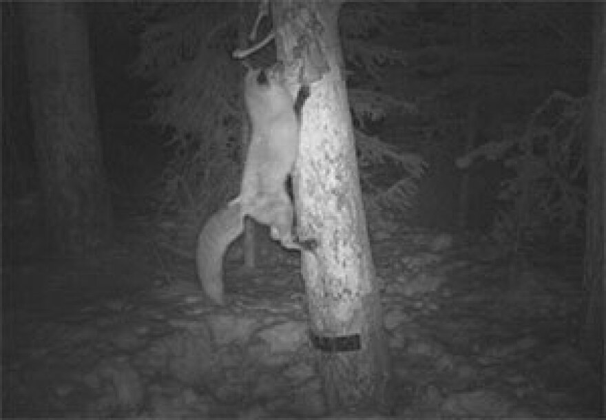
Austin Smith: For our case, you know, the research that I had conducted was based around forest-dwelling species. And so for instance, it was forest carnivores such as Pacific Martins, Montane Red Foxes (which are a subspecies of red foxes that live up in these colder mountainous environments), coyotes (we're starting to see more and more of where they're living in these mountainous, forest environments, especially through the winter) and then common prey species like snowshoe hares and red squirrels.
So of the carnivores, they are all highly mobile species, particularly martins and red foxes. They require large home ranges, lots of area, their livelihood kind of depends, and their survival depends, on these forest structures – and that's for survival, reproduction, movement, etc.
One of the issues that ends up being is when we're trying to further our understanding on large expansive levels or landscape levels. For some of these species, we become limited by the data that's available to us. It is often just with two-dimensional, flat-surface information. So what kind of trees may be there, how much coverage of canopy may be there, elevation, slope, all those kinds of things. And LiDAR, in its simplest form, can be flown on fixed-wing aircrafts. People can also do it terrestrially where they are under the canopy forest tops and kind of being able to map the three-dimensional structure under forced canopies. The issue ends up being that it can be small scale, where it's covering really small areas, because it can be, especially in the past, expensive. It can be limited, again, to large spaces. And so when we have these species that require large areas that can get really expensive.
So kind of long story short, this project saw this opportunity to take these products and metrics and stuff that would be coming from the GEDI mission, that provides us with three-dimensional information such as canopy height, vertical cover, and complexity of the forest, that then we could essentially expand. And we had to do a little bit of modeling aspects and really couple this with other remote sensing information, like Landsat 8, which is a really common long-term satellite series of satellites, that's in space going around collecting images of the forest – continuous photos of the earth. And we pair that with this, based off this three-dimensional information. And then we can actually predict, and then create, structured maps across a large expanse of areas that then provide us that extra bit of information, using vertical and horizontal cover. And then we can apply that, to see if we can improve our understanding of these different predators and prey that are living within these forest environments. If we could improve it, get a little bit more information about how they might be using this landscape at a large landscape scale.
Caitlin Tan: So just to make sure I'm understanding, it sounds like what you're saying is, this technology is allowing you guys to further understand the species and to understand where they are and where they're occurring in these regions. Would you say that's correct?

AS: Yeah. So for forested species that sometimes we get kind of a scale at which they occur, it was an additional piece to be able to add, to look at contributions to l where these species occur. And some of the stuff is known. Like horizontal cover and coverage in snow environments. And often multistoried forest environments are really important for snowshoe hares; it's been seen throughout the literature. So it's not necessarily anything particularly new, but it was the ability to be able to use this combination of GEDI, and Landsat 8, both also free products that are available to the public. So it's research that puts tools in the toolbox for researchers and for managers, and it’s things that you can then add to ask additional questions at these larger, expansive scales. So it's great to see that this approach and that these GEDI products are contributing to furthering our understanding of the species.
CT: So then going forward, how do you anticipate potentially using this technology? And do you think it could potentially start to be applied to finding out answers to things that we don't yet know?
AS: Yeah, so GEDI is still working up on the International Space Station, but it's covering the entire earth. It's covering all of our forested environments, from tropical to temperate, and it provides us a global expansion of information. Landsat and Sentinel and some of these other remote sensing products, and others from other missions, I think there's a couple out of Japan, and then there's some out of the EU that we can apply this and then work these products together. And then we can start applying this to other landscapes and other animal species. So for example, maybe we go down into more of the tropical environments, and use this to help with an assessment for orangutans or some other sort of tropical or temperate bird species, maybe some form of the spotted owl. You know, these other landscapes that the information will be there, and then essentially the same kind of methods can be applied. So we can be wherever we want in a forest environment, and hopefully, the results can be very similar. And then we can assess information for other species. So, that is really important.
Given that this is at such a large scale, for being able to map this information, it allows us to then look at large-scale disturbances, especially out here in the West. In our western forests, we can start to use this to assess wildfire or bark beetle outbreaks. The GEDI overall mission, just for their application, is to hopefully improve their ability to characterize important carbon and water cycle processes, and then in our case, kind of the biodiversity, and then habitat, like deforestation and things of that sort.
So, GEDI as a whole is going to have great implications across the globe. And then even for us here in the United States or really North America, being able to focus on wildfires, and bark beetle outbreaks, it'll be significantly helpful.
Another thing we're hoping for in the near future is to actually incorporate this information into looking at GPS-collared animals to see how the power potentially of these maps of forest structures could help us to characterize animal environment relationships that are varying through time and space. So as these animals are moving about the landscape, we can then assess, are they maybe selecting more or are occurring more in super dense forests? Or are they more on maybe less dense, but really tall forest stands or something? All kinds of different applications on how we can look into other metrics. It's just going to take more time to just play with those and see how we can apply them to our future conservation, management, and research of species.
CT: Is there anything else you want to add for now to share with the listeners?
AS: Hopefully, I was able to capture the power that GEDI has, especially when it's paired and used with other remote sensing platforms. We're going to hopefully just be able to keep moving forward and applying this information and just really getting to have a better understanding of our forest-dwelling species and those forested habitats.


