-
 Drought relief may only be temporary.
 -
 Peter Sinks in Logan Canyon gets remarkably cold. Here's how scientists say that could teach us about inversions.
 -
 Blame wildfires and hail — made more destructive by climate change — for the deteriorating insurance situation in the West. Add in hurricanes and other disasters elsewhere, and it’s a nationwide trend — one that a new report from the advocacy group the Insurance Fairness Project says is threatening home sales.
 -
 Fishing restrictions on the Firehole, Madison and Gibbon rivers were initially implemented in July due to low water levels and high temperatures.
 -
 The weather pattern favors dry conditions in the northern Rockies and wet conditions in the southern Rockies with some uncertainty in between.
 -
 Dozens of daily high records were broken from July 11 through 15 across the state, with Worland and Clark hitting 111 degrees on Monday.
 -
 This year’s already strong El Niño is strengthening, a trend with potentially significant implications for the intense – and now tragic – fire season.
 -
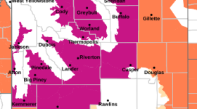 “Dangerously hot conditions” are forecast, with temps likely to top triple digits.
 -
 Fire weather days are different than fire season. They are increasing due to climate change.
 -
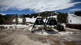 Some resorts saw half their normal snowfall totals. Casper’s Hogadon Basin saw a third of typical skiers. Resort managers reflect on the unusually warm season and its financial impacts.

© 2026 Wyoming Public Media
800-729-5897 | 307-766-4240
Wyoming Public Media is a service of the University of Wyoming
800-729-5897 | 307-766-4240
Wyoming Public Media is a service of the University of Wyoming

Play Live Radio
Next Up:
0:00
0:00
Available On Air Stations


